Trail 462
Anello delle pedate del cavallo di San Giovanni Gualberto
San Giovanni Gualberto was born around the year 1000 in Petroio near Tavarnelle Val di Pesa. After forgiving the murderer of his brother, he became a monk and later founded the monastery of Vallombrosa, following the Benedictine rule. In the final years of his life, he withdrew to Badia a Passignano, where he is buried in the church of San Michele Arcangelo. In 1951, Pope Pius XII proclaimed him the patron saint of the Italian Forestry Corps (today the Carabinieri Forestali).
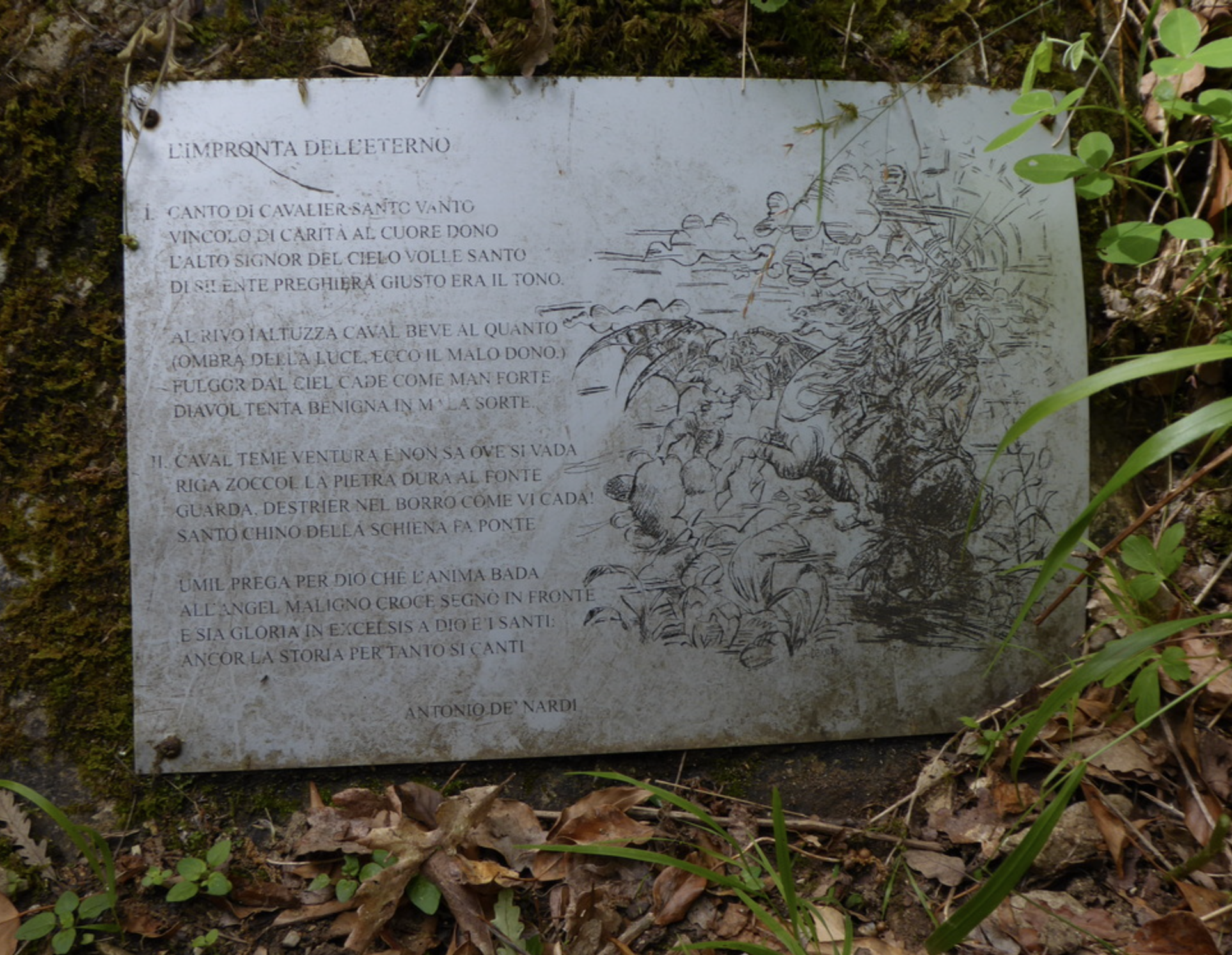
According to legend, while descending from Badia a Passignano towards the Abbot’s Mill, San Giovanni Gualberto encountered the devil in the woods near the Borro della Ialtuzza. His frightened horse fell violently, leaving hoof-shaped impressions in the rock beside the stream, still visible today and known as the “Devil’s Footprints.”
The trail begins along the Pesa River, about one kilometre from the historic bridge of Sambuca. It climbs through woodland via a series of switchbacks to the junction marked “Pedate del Diavolo.” Turning left, the path descends gently to the stream bed of the Borro della Ialtuzza, where circular rock formations recall the legend. A faint, recently blue-marked path allows a direct continuation toward Badia a Passignano.
Returning to the junction, the route continues uphill to a dirt road coming from the Pesa valley. The circular walk then follows white gravel roads and forest tracks, passing farmhouses and vineyards, reaching the high point near San Brizzi, before descending through the countryside of Montebernardi and finally returning along the Pesa River to the starting point.
A scenic loop combining legend, history, forests, vineyards, and river landscapes in the heart of the Chianti region.
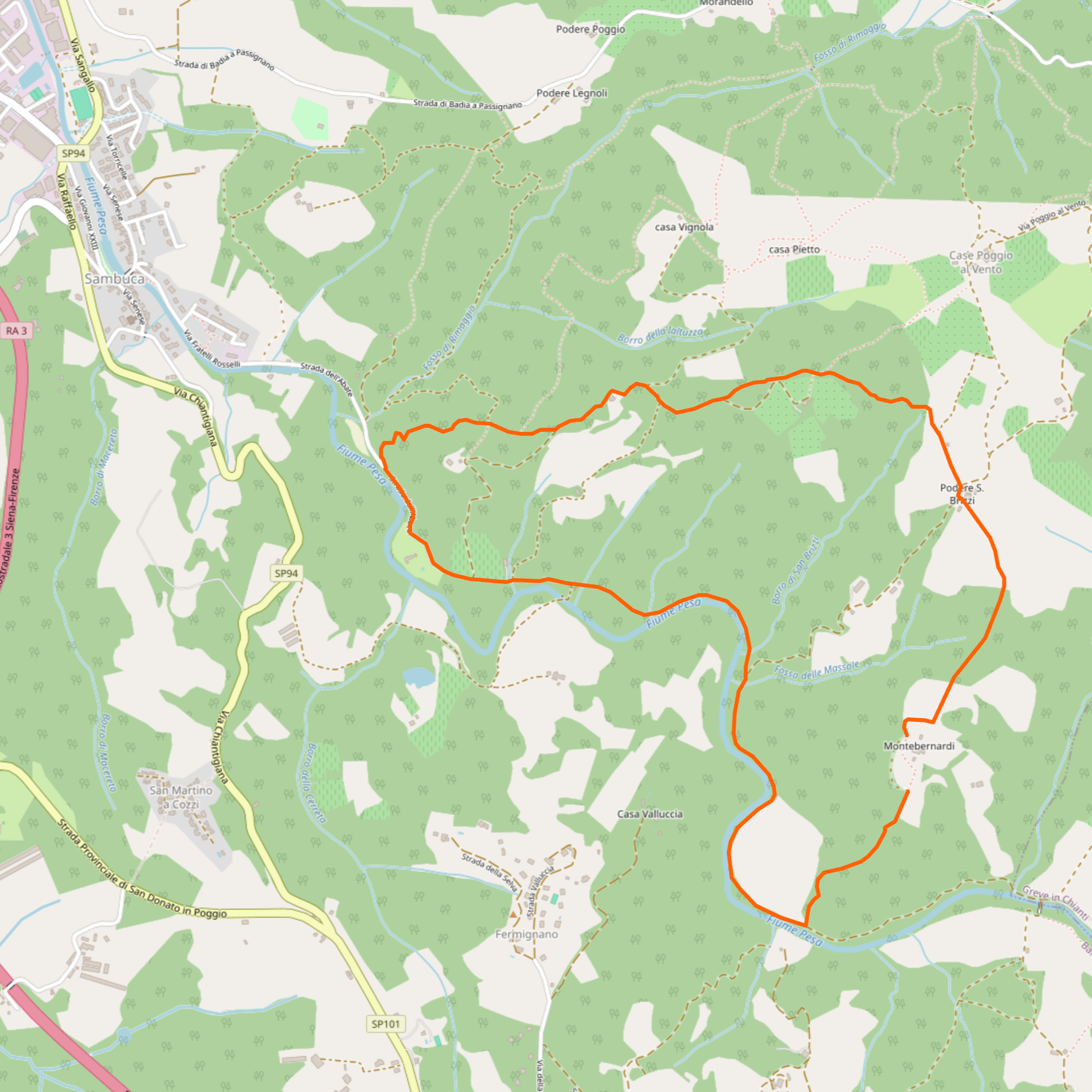
Credit to openstreetmap.org
Trail Overview
Distance: 7.4 km
Duration: approx. 2 hours 30 minutes
Difficulty: Easy to Moderate
Elevation gain: 315 m
Access: By car or public transport to Sambuca
Recommended map: CAI Firenze – Map 4
Category: Barberino-Tavarnelle trail network
Area: Chianti Fiorentino, Val di Pesa
Credit to caifirenze.it